The Twinbrook Connector Trail, which connects Twinbrook to the Rock Creek Trail
Completed July 24, 2020
Fishers Lane is a short street that crosses Twinbrook Parkway (TP) from the southern part of the Twinbrook neighborhood in Rockville MD -- I live in Twinbrook, hence my interest. On the corner of Fishers and TP is the headquarters of the United States Pharmacopeial Convention, and at the eastern terminus is the rear entrance (usually closed) of Parklawn Cemetary. On the south side at that end of Fishers is the old FDA headquarters, partially renovated partially empty. (Coincidentally, I worked there before and after my 1st year of law school in the summers of 1983 & '84; yes, I'm olde....)
On the north side of the east end of Fishers, on the east corner of Rock Creek Mill Road, is the National Institute of Allergy and Infectious Diseases (NIAID) headquarters. Ubiquitous developer JBG built the NIAID building, and was required (by the County) as part of the project to build a hiker-biker trail from the end of Rock Creek Mill Road to the Rock Creek Trail (RCT). Alot of things happened along the way, as you can read below (chronologically from the bottom) if you're curious.
Click here to watch a video I recorded riding from Twinbrook (Fishers Lane crossing Twinbrook Parkway) to the trail to the RCT (2 days after it was opened, so there's still residual orange fencing, the Veirs Mill shoulder foliage hasn't been trimmed, and there's a dearth of signage)
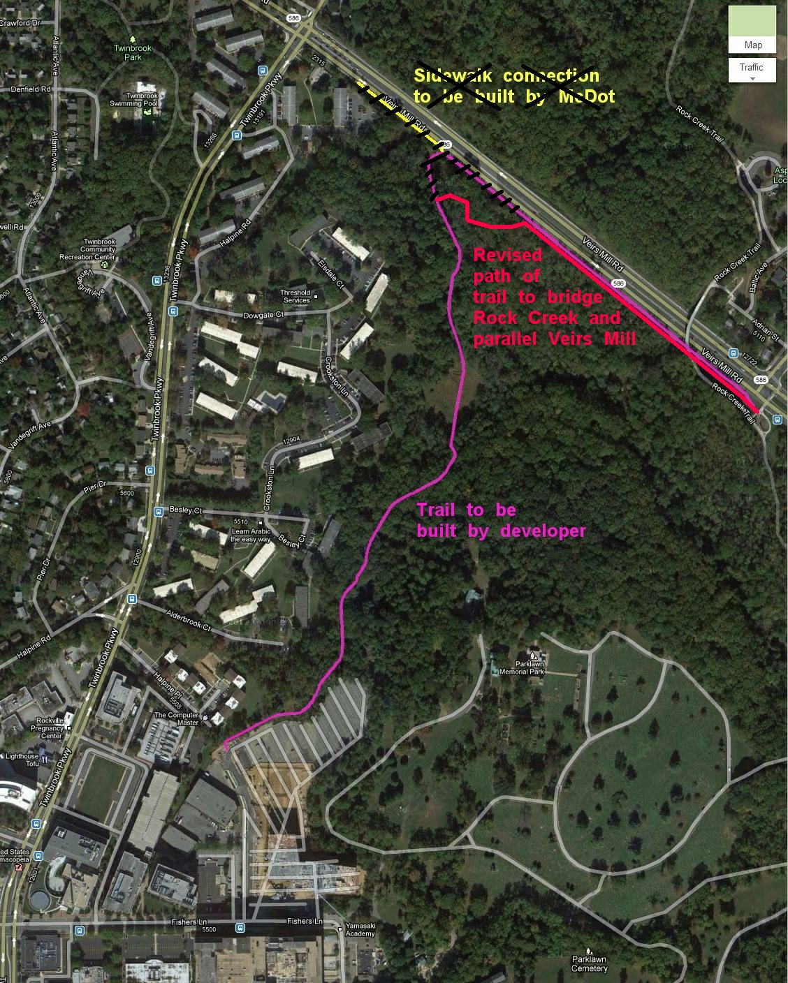
Long story short (beaucoup details below): If you scroll to the bottom of this page you'll see the original plan, which shows the trail heading more or less straight north to Veirs Mill, and then running along the wide Veirs Mill shoulder to the RCT. Then the County started planning Bus Rapid Transit (BRT) routes, and decided one of those would run along Veirs Mill and use that shoulder. As a result, JBG was required to come up with a plan for the trail to go through the woods south of Veirs Mill, which also required a new bridge over Rock Creek (the Veirs Mill bridge no longer being available). JBG pointed out to the County that this would cost more money than they'd originally planned, so the County agreed to let JBG pay $1 million and the County Department of Parks would finish the trail. JBG finished the trail as far as building the bridge, then Parks ignored the plans, built a minimal "natural surface" trail through the woods (which are wetlands), and declared it was done. Leading up to that, they lied to me repeatedly about finishing the trail as planned (which, granted, would be pricey, because wetlands require boardwalks or the equivalent, as shown on the plans). I and others whined and puled, who knows to what effect, and eventually Parks decided to run the hard-surface trail along the Veirs Mill shoulder, which was now possible because the plans for the BRT had since been dropped / postponed indefinitely. Parks then did a SPECTACULAR job on the shoulder portion of the trail and the zigzag path from the bridge to get there. Ironically, we've ended up with a trail almost identical to the original plan, except for the separate bridge, and it is indeed wonderful.
Below is the reverse-chronology of my obsession with this trail:
UPDATE: 25 July 2020
IT IS DONE!
Except for a little more signage, removing the rest of the orange fence, and trimming the foliage on the south side, which will be done very soon....
The signage that we hope will deter cars from driving from the shoulder into the trail:

UPDATE: 16 July 2020
The Veirs Mill guardrail is done at the SE end and open-but-blocked at the NW end -- soon?!?


UPDATE: 11 July 2020
The Veirs Mill guardrail is almost done!


UPDATE: 09 June 2020
The path to Veirs Mill is paved (but still blocked):


UPDATE: 07 June 2020
The "detour" is underway!


UPDATE: 9 December 2019
From Parks: "The attached PDF shows the connector alignment and a profile (please note that it is in review with SHA, and some elements may change). It will be asphalt. ... [T]he existing rise to the shoulder of MD 586 is quite steep, so we will be grading the entire trail connection to a maximum slope of 5% to meet ADA guidelines and provide accessibility to all users."
UPDATE: 30 October 2019
From Parks: "current estimated schedule; things may shift depending on SHA response times: Submit revised drawings back to SHA November 2019 / Obtain SHA permit approval December 2019 / Address maintenance agreements with SHA and procure a contractor throughout Fall and Winter 2019/2020 / Construction Spring 2020"
UPDATE: 29 May 2019
UPDATE: 22 April 2019
UPDATE: 6 April 2019
Ah well, the consideration of finishing the paved trail apparently didn't last long. From Parks:
In the context of all that's gone on, this is less horrible. The natural surface trail is somewhat rough, and unridable after any sort of precipitation, and dealing with the slope and guardrail to ride the shoulder instead is a major pain.[P]arks is expecting comments back from SHA on design any day now, and expect they will be able to start work on painting, striping, and installing some pavement bumps for the Veirs Mill shoulder bikeway connection this summer[, including a guardrail opening and asphalt ramp up to Veirs Mill]. As part of the agreement with SHA, this is a first step and they also hope to install some flex posts or similar barrier later but this requires an MOU with SHA which takes a while to process, and parks didn�t want to wait for final approval of an MOU before beginning work on the bikeway.

UPDATE: 25 October 2018
Parks is maybe reconsidering actually finishing the trail
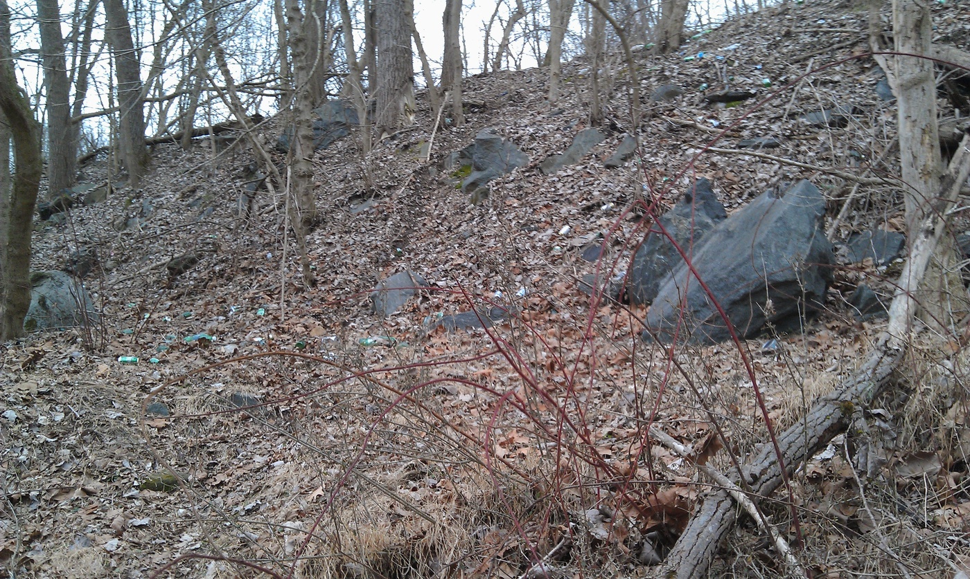
Various pleas were fruitless, there was no funding made available to complete the trail. As a result, non-mountain-bike riders are forced to ride the unprotected Veirs Mill shoulder, lift their bikes over the guard rail, then navigate the detritus-strewn steep slope and a short stretch to get to stupid end of the paved trail at the east side of the bridge.
Parks was pondering putting a temporary trail on the edge of the southeast-bound Veirs Mill shoulder, connecting the stupid end of the connector trail to the RCT, which would have been ugly but safe, but they notified me today that they're not doing that after all:
Sigh. I note the "parkland" portion of the uncompleted trail has already been thoroughly designed. But I think this is good, because Parks had previously decided to not finish the Twinbrook Connector parkland trail and chose to keep that information from the public, consistently telling us it would be done, while having no funding and no intention to try to get funding. Now they say they are going to strive for funding to finish it. This is an absolute improvement, and I have a modicum of faith in their current veracity. We can only hope that the Commission gets on board as well, since it is the well from which sweet trail-building funding springs.As I reported to you previously, Parks staff submitted a concept plan to Maryland State Highway Administration (SHA) for a permanent trail connector within the paved shoulder of MD 586. SHA has concerns about shoulder clearances and maintenance with a concrete barrier capable of deflecting a vehicle away from trail users. They would accept a temporary connector (for 2-3 years) within the paved shoulder of MD 586, consisting of flexible posts or plastic barriers and pavement markings. However, M-NCPPC staff has safety concerns about routing two-way bicycle traffic and pedestrian users within the shoulder of MD 586, as the speed limit is 45 mph with high traffic volumes, without some sort of substantive barrier separating trail users from traffic.
After further discussion with SHA and internally within M-NCPPC, we do not believe installing the temporary connector on MD 586 is the best course of action given its cost ($150,000�), maximum duration of 3 years, and considerable safety issues (as no barrier separation would exist between MD 586 traffic and trail users). We are now moving forward with design of a paved trail connection on Parkland, completely off MD 586, to connect the Twinbrook Connector with the Rock Creek Trail.
We anticipate design of this connector and environmental permitting occurring through Summer 2019. As part of this effort we will develop a cost estimate, which will enable us to request construction funding in the upcoming Capital Improvements Program. We will also pursue alternative sources of funding to help expedite the project. In the meantime, we are also coordinating on ways to improve the existing natural surface trail connection already in place.
UPDATE: 27 February 2018
Parks finishes ... The Trail to Nowhere
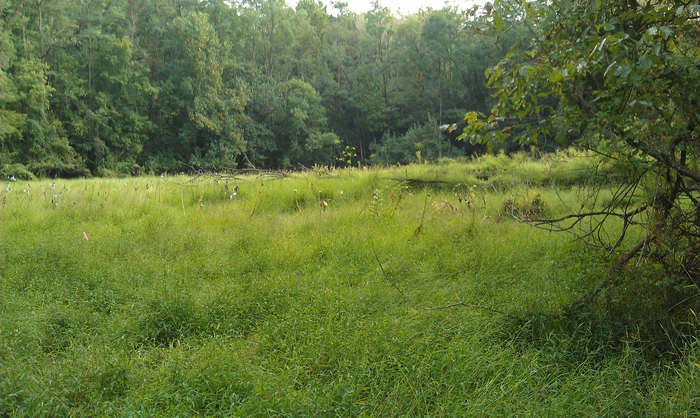
In early November 2017 I learned for the first time that Parks had neither funding nor inclination to actually finish the trail. When Parks representatives had been telling me they would be "finishing" the trail soon, they meant they were going to run a Bobcat on a wandering track through the wetlands alongside Veirs Mill, creating a muddy "natural trail" crossing two small creeks, and petering out to the east near the big bridge.


UPDATE: 31 October 2017
WSSC is almost completely gone!


UPDATE: 17 September 2017
Pro: cleaning up, looking good! Con: temporary bridge to Veirs Mill is gone


Minor UPDATE: 24 August 2017
WSSC is working!


UPDATE: 4 August 2017
It's paved all the way to the bridge: click here for video!
As great as this is — and it IS — there is nothing going on on the east side of the bridge.
Because WSSC is still dawdling (see below), and there's no way to know when they will finish — WSSC told me last July that it would be done by May this year — I've asked for an update.
There's alot to be done over there, hard surface trail and three boardwalks (see the pink portions here and the nitty-gritty details here).
McParks tells me the wee boardwalk that will abut the Rock Creek bridge will be built imminently, but the rest waits for WSSC....
But wooHOO, you can walk or ride the paved portion now!
At the north end you have to traipse a short ways to Veirs Mill and walk/ride the shoulder to get to the Rock Creek Trail, not pleasant at all.
And, duh, they're still working on it, don't try to use it during weekday work hours.
UPDATE: 3 June 2017
Lots of progress on the western side!


UPDATE: 18 February 2017
The bridge is up!


UPDATE: 19 June 2016
Work has begun!
From McParks in April:
The first phase, starting at Veirs Mill, is underway. The contractor has installed tree protection fence and sediment controls and has proceeded with the tree clearing. The work includes the large bridge across Rock Creek and we anticipate completion of this phase in about three months.Once we receive the aforementioned easements and permits for the second phase, the anticipated construction duration for phase two will be about four months. We hope to have the trail completed in November, but this schedule may be impacted by the work performed by WSSC. We have had several coordination meetings with them at the site and, for now, they anticipate that they will need access through the site for much of 2016. They will need to use the temporary access roads until their work is complete. We will be able to complete our project once the mats have been removed.
I rode around in there on 18 June -- the yellow line is my route (riding mostly on WSSC temp roads) superimposed on the path the trail is going to take (purple/red):


UPDATE: 4 April 2015
The final, approved Forest Conservation plan is here. Lots of nice details. From McParks:
JBG received bids from contractors on this project. Parks staff met with JBG representatives and went over the bids together two weeks ago. We agreed on the implementation strategy and JBG is working with the low bidder to clarify certain bid items. Hopefully they can finalize the contract soon. In the meantime, JBG and the Commission need to enter into an agreement to build the trail. We hope the construction can start this summer to take full advantage of the prime grading/construction season.
UPDATE: 12 July 2014
Current revised plan, soon to go out for bids -- the path is shown in purple, with bridges and boardwalks in red (click on it to see it much larger):
UPDATE: 29 Jan 2014
The revised plan was approved by the Planning Board on 23 Jan -- the staff report is here and the staff slides here. JBG is committing $900K and will work with Parks staff to build the trail, and if it costs more than $900K then Parks will strive to come up with the money, or the trail will remain uncompleted until Parks can finish it. While not optimal, I think this is a reasonable resolution that gets the project moving. The �design and permit plans for the full length of the Trail� are due 1 Apr. Below is a slightly revised map of the new alignment shown roughly in red:

UPDATE: 8 Nov 2013
From McParks' Steve Findley:
"Not a done deal yet, but more progress. The applicant (JBG) continues to offer resources considerably exceeding their required PAMR payment to get the trail built, but are concerned that the cost of constructing the trail will be well above that level of payment. The Planning Department has agreed to cap the total financial commitment from JBG. The Parks Department appears willing to step in and provide the rest as long as costs to them are not exorbitant, and to potentially provide an interim natural-surface trail connection until the entirety can be paved. Next steps: Parks Department engineers will work with JBG�s consulting engineers from VIKA to �value engineer� the trail design to reduce costs. Then hopefully JBG can finish the design and secure permits, then bid out the trail for construction. Bidding the project cannot occur until the final design is completed, and permits are secured. The likely time line is that the project will be bid sometime next summer. The actual cost from the bid will determine how far JBG�s commitment will go and how much the Parks Department has to provide to fund completion of the trail. Everyone agrees that we want to see it done, and that it is a priority. A couple of weeks ago, I was concerned that this trail might not happen after all. The willingness of the Parks Department to take on some of the construction cost has revived the project. In the meantime, we are working on a Site Plan amendment to allow JBG�s Federal client, NIAID, to occupy the building just after the first of the year."Sigh.. . . . . . . .
UPDATE: 24 May 2013
Below I've superimposed the path of the new trail in pink on an aerial shot of the area -- [UPDATE] with the new alignment shown roughly in red:
UPDATE: 11 May 2013
Yay, from McParks' Steve Findley:
"JBG and the Parks Department have tentatively agreed on a revised alignment that roughly follows the approved plan but moves the trail off of Viers Mill Road and puts it on Montgomery County Park land parallel to the road. The biggest issues now are: (1) This requires a separate bridge over Rock Creek to carry the trail, requiring both more cost and additional engineering; and (2) this will require additional permits from Maryland Department of the Environment for wetland and floodplain disturbances. We have met in the field with MDE, and they have indicated a willingness to grant the permit if they feel the impacts are justified. The Parks Department is going to write a letter to MDE in support of JBG�s permit request.
"Meetings are now occurring between the Parks Department, the Planning Department, and JBG and their consultants to expedite the new engineering and plan amendments to make this happen. I have to give credit to JBG for taking on the additional work and expense of the revised alignment, and to the Parks Department for agreeing to take more of the trail, with its impacts, maintenance and policing responsibilities onto their property to make this happen. It isn�t a done deal yet, but, absent any �stoppers� it is moving toward a solution. This will take a few more months to get to construction, but we are beyond the impasse."
UPDATE: 17 February 2013
I recently learned that problems have arisen with the plan shown above, because of plans Maryland has for Veirs Mill that will use some or all of the existing huge shoulder. As a result, they are evaluating alternatives -- I don't know what they are yet.
So, pup and I took a hike. I parked in the soccer fields lot, walked along the cemetery driveway to the southwest side of Rock Creek, and walked along the southwest side up to Veirs Mill, then back along the Veirs Mill shoulder (not pleasant, that last part):


26 September 2012
When I first learned about this trail, I walked around the area to try to figure out where the trail would go. I found some pink wire+plastic markers with VIKA written on them, which is the name of the engineering contractor designing the trail:


In the beginning: Fall 2012
The trail will provide easy hiking / cycling access from the southern part of Twinbrook to the RCT, which is currently (2012) dangerous (Veirs Mill, wide but terrible shoulder, very fast cars) or inconvenient (Linthicum, okay if you're going north to Lake Needwood or Lake Frank, way out of the way if you're going south):